CASE STUDIES
Station Road, Crewkerne - Comprehensive Flood Risk Assessment & Drainage Strategy
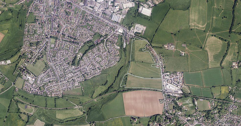
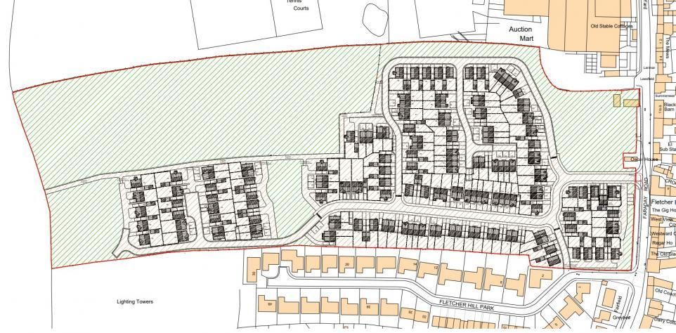
Enviren prepared a comprehensive Flood Risk Assessment and Drainage Strategy in support of a planning application for 325 dwellings and associated infrastructure on land west of Station Road, Crewkerne.
The assessment demonstrates that, with appropriate mitigation, the scheme is safe from flooding and will not increase flood risk elsewhere.
Site Overview
Site characteristics
- Location: West of Station Road, Crewkerne, Somerset
- Site area: 16.532 ha
- Existing land use: Agricultural (less vulnerable)
- Proposed use: Residential (more vulnerable)
Topography & Hydrology
Runoff flows north toward the River Parrett
A watercourse runs along the west of the site, eventually discharging to the River Parrett
Flood Zone Status
The entire site lies within Flood Zone 1 (lowest fluvial/thalassic risk)
Sources of Flood Risk
The FRADS assesses all flooding mechanisms as required by the National Planning Policy Framework (NPPF).
Fluvial flooding
Very low risk — site is entirely Flood Zone 1
Surface water (pluvial)
Very low risk across the developable area
Groundwater flooding
Low risk, but the report identifies the need for ongoing groundwater monitoring
Sewer flooding
Very low risk
Reservoir flooding
Very low risk, reservoir flooding does not reach the site
Surface Water Drainage Strategy
Core principles
The drainage strategy adheres to:
- The SuDS hierarchy
- Somerset Council requirements
- NPPF and Planning Practice Guidance
Primary discharge option — infiltration
The report recommends infiltration-based drainage where viable.
Evidence for infiltration viability
A separate supported soakaway investigation confirms:
- No groundwater encountered in any trial pits
- Limestone and clay strata across the site
- Infiltration rates were successfully established in several pits.
Fallback strategy
If further sitewide infiltration testing finds areas unsuitable or if groundwater rises:
- An alternative drainage layout has already been prepared
This ensures the scheme can manage runoff under all expected conditions.
Foul Water Strategy
The FRADS confirms:
- Foul water will discharge to the main foul sewer along Station Road
There is no reference to requiring on-site treatment or alternative foul measures in this document.
Flood Risk Mitigation Measures
The FRADS prescribes the following:
Groundwater monitoring
- Required to track seasonal variations and identify potential rising trends
SuDS features
The strategy incorporates:
- Swales
- Attenuation basins
- Porous surfaces
- Rainwater harvesting
- Greenfield runoff compliance
All surface water discharge is constrained to greenfield runoff rates and volumes.
Catchment impact
Runoff will be managed entirely on-site through infiltration, ensuring no downstream flood risk.
Summary of Post-Mitigation Flood Risk
Table 8.1 shows:
| Flood Source | Residual Risk | Reason |
|---|---|---|
| Fluvial | Very low | Flood Zone 1 location |
| Pluvial | Very low | Surface water not affecting site |
| Groundwater | Low | Monitoring recommended |
| Sewers | Very low | No sewer flooding expected |
| Reservoirs | Very low | No influence on site |
| Wider catchment | Very low | All runoff to infiltrate on-site |
Final Conclusion
According to the FRADS:
“Providing the flood mitigation strategies outlined in this document are implemented, flood risk should not prevent approval being granted to this development.”
The site is demonstrably safe from all key flood sources, and the drainage strategy—primarily infiltration—ensures no increase in flood risk to the wider catchment.
PROJECT DETAILS
CLIENT
GTH
LOCATION
Crewkerne
OFFICE
Bristol
COMPLETED
2025
More Case Studies