CASE STUDIES
Earle Street, Yeovil - Flood Risk Assessment & Drainage Strategy
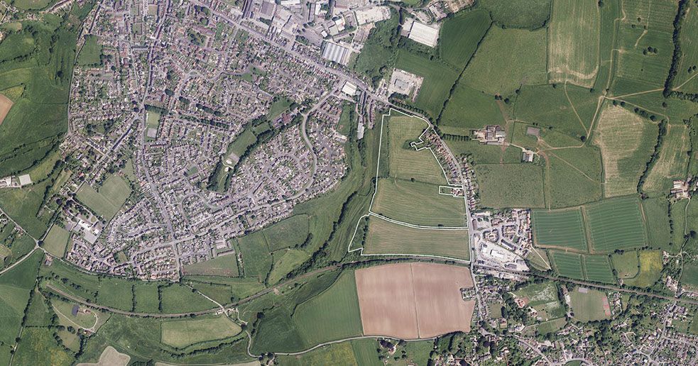
According to a document from 2021–2024, the Flood Risk Assessment and Drainage Strategy (FRADS) was prepared to support the redevelopment of a block of flats at a site off Earle Street, Yeovil, Somerset.
The report evaluates fluvial, surface water, sewer, and overland flow risks and provides a comprehensive drainage strategy to ensure the scheme will not increase flood risk locally or downstream.
Project Overview
The FRADS confirms:
- Development type: Block of flats
- Location: Construction Site, Earle Street, Yeovil, BA20 1JW
- Purpose: To demonstrate that the development can be safely designed in respect of flooding and that runoff can be managed effectively.
- Objective: Mitigate all identified flood risks and provide a compliant drainage strategy under NPPF requirements.
Assessment of Flood Sources
The FRADS evaluates all flood risk types.
Fluvial Flooding
- The River Yeo is ~330 m south of the site.
- Assessed risk: Low.
Surface Water Flooding (Pluvial)
- Surface water flooding will not affect the development based on modelling and capacity checks.
Sewer Flooding
- Sewer flooding does not affect the development site.
Reservoir, Canals & Tidal Flooding
- All assessed as no risk or low risk.
Overall:
All sources of flooding to the proposed development are Low or None.
Overland Flow & Culvert Capacity Analysis
A major element of the FRADS is the hydraulic assessment of upstream catchment flows and the capacity of the culverted system.
Key Findings
- CCTV survey (Appendix I) identified sedimentation and deposits, so a 20% reduction in hydraulic capacity was applied for conservatism.
- Even with this reduction:
- Northern catchment flow: 3136.1 l/s
- Eastern catchment flow: 154.6 l/s
- Culvert beneath site: 1449.2 l/s
- Culvert under Wyndham Street: 4187.4 l/s
- Free capacity available: 2253.1 l/s
- The off-site combined sewer system contributes to historical flooding elsewhere in Yeovil, but this is independent of the development and not attributable to flows from the site.
- The hydraulic assessment confirms that surface water flooding need not be considered further because the culverted system is sufficiently oversized.
Impact of Development on Catchment Flood Risk
- The development introduces only a small increase in impermeable area.
- The strategy incorporates appropriate mitigation, ensuring no worsening of flood risk downstream.
Drainage Strategy
The drainage design emphasises:
Surface Water Management
- Removal of surface water discharge from combined sewers → reduced CSO discharges into the River Yeo.
Water Quality Protection
- Treatment train includes permeable paving and a bypass separator.
- Assessed using the CIRIA C753 Simple Index Approach.
Overall Performance
- Significant betterment in discharge rates over the existing situation.
Overall Conclusion
The FRADS concludes:
- The development is not at significant flood risk for its design life.
- Surface water can be safely managed using the proposed drainage strategy.
- Downstream flooding and water quality impacts are improved, not worsened, by the development.
PROJECT DETAILS
CLIENT
Hinton Group
LOCATION
Yeovil
OFFICE
Bristol
COMPLETED
2024
More Case Studies